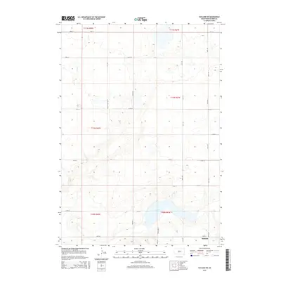
2015 Map of Vayland SW
USGS Topo · Published 2015About this map
Danforth anchors the southeastern corner of this modern survey of the South Dakota prairie, where a strictly geometric grid of county roads divides the landscape into expansive sections. The topography is defined by significant natural drainage systems, including the headwaters of Turtle Cr in the north and the prominent depression of Spring Lake. This region of Hand County reflects the enduring patterns of Great Plains ranching and agriculture, with named access routes like Beckett Ranch Rd and Spring Lake Rd serving isolated farmsteads. The map illustrates how local geography dictates transit, as roads like 216th St and 365th Ave navigate around the wetlands and fluctuating water levels of the glacial till landscape.
Find a feature on this map
24 named features on this map. Tap any name to fly to it.
Don’t see what you’re looking for? This feature index may not catch every label — zoom into the map to look around manually.
Map Details
Editions of this 2015 Vayland SW Map
This is the sole edition of this map. No revisions or reprints were ever made.
Other maps of this area

1949 · Vayland SE
USGS Topo · 1:24,000

1949 · Vayland SW
USGS Topo · 1:24,000

1950 · Vayland
USGS Topo · 1:24,000

1950 · Vayland NW
USGS Topo · 1:24,000

1951 · Vayland SW
USGS Topo · 1:24,000

1951 · Vayland SE
USGS Topo · 1:24,000

1953 · Huron
USGS Topo · 1:250,000

1954 · Huron
USGS Topo · 1:250,000

1973 · Ames
USGS Topo · 1:24,000

1973 · Big Bend Dam 4 NE
USGS Topo · 1:24,000