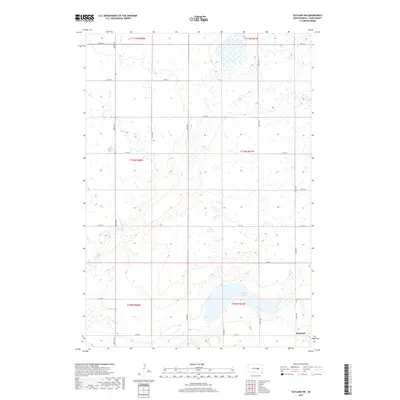
2017 Map of Vayland SW
USGS Topo · Published 2017About this map
Danforth stands as a primary point of interest in this agricultural landscape of Hand County, situated in the southeastern portion of a region defined by its vast township grid system. The terrain is marked by significant hydrological features, most notably Spring Lake and the winding course of Turtle Cr. This 2017 survey reveals a remarkably consistent section-line road network, where routes like 364th Ave and 216th St provide the backbone for rural transit. The mapping of Co Rd 7 underscores the area's continued reliance on county-maintained infrastructure to connect isolated homesteads. The distribution of small prairie potholes and wetlands across the northern sections reflects the characteristic glaciated topography of the South Dakota plains, influencing the placement of farms and roads within townships like t110n r67w.
Find a feature on this map
24 named features on this map. Tap any name to fly to it.
Don’t see what you’re looking for? This feature index may not catch every label — zoom into the map to look around manually.
Map Details
Editions of this 2017 Vayland SW Map
This is the sole edition of this map. No revisions or reprints were ever made.
Other maps of this area

1949 · Vayland SE
USGS Topo · 1:24,000

1949 · Vayland SW
USGS Topo · 1:24,000

1950 · Vayland
USGS Topo · 1:24,000

1950 · Vayland NW
USGS Topo · 1:24,000

1951 · Vayland SW
USGS Topo · 1:24,000

1951 · Vayland SE
USGS Topo · 1:24,000

1953 · Huron
USGS Topo · 1:250,000

1954 · Huron
USGS Topo · 1:250,000

1973 · Ames
USGS Topo · 1:24,000

1973 · Big Bend Dam 4 NE
USGS Topo · 1:24,000