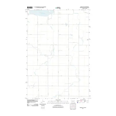
2011 Map of Veblen NE
USGS Topo · Published 2011About this map
Lake Tewaukon anchors the northern reaches of this borderland landscape where North Dakota and South Dakota meet. The terrain is defined by a grid of rural sections drained by the winding courses of LaBelle Creek and Shortfoot Creek. This 2011 survey reflects the enduring agricultural character of the prairie, showing a sparse network of farmsteads connected by graded roads like County Hwy-12. For those researching local family history, the Bergen Cemetery stands as a primary landmark in the eastern portion of the quadrangle. The map captures a moment of modern stillness in the Great Plains, where the drainage patterns of the creeks still dictate the placement of roads and the boundaries of fields as they have for generations.
Find a feature on this map
26 named features on this map. Tap any name to fly to it.
Don’t see what you’re looking for? This feature index may not catch every label — zoom into the map to look around manually.
Map Details
Editions of this 2011 Veblen NE Map
This is the sole edition of this map. No revisions or reprints were ever made.
Other maps of this area

1907 · Wyndmere
USGS Topo · 1:125,000

1953 · Milbank
USGS Topo · 1:250,000

1953 · Fargo
USGS Topo · 1:250,000

1956 · Fargo
USGS Topo · 1:250,000

1958 · Milbank
USGS Topo · 1:250,000

1958 · Hillhead
USGS Topo · 1:24,000

1958 · Veblen
USGS Topo · 1:24,000

1958 · Marlow
USGS Topo · 1:24,000

1958 · Veblen NE
USGS Topo · 1:24,000

1958 · Geneseo
USGS Topo · 1:24,000