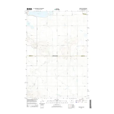
2014 Map of Veblen NE
USGS Topo · Published 2014About this map
Lake Tewaukon and the surrounding prairie wetlands dominate this borderland landscape where Sargent County meets Marshall County. The topography is defined by the drainage of La Belle Cr and Shortfoot Cr, which carve subtle paths through the glacial terrain. A rigid grid of rural section roads, including CR-12 and 100th St SE, organizes the agricultural landscape, reflecting the systematic land survey patterns of the Great Plains. The Bergen Cem stands as a quiet marker of the area's early settlement history near the eastern edge of the survey. The mapping also records the precise intersection of the North Dakota and South Dakota state line, illustrating how political boundaries overlay the natural hydrology of Bessler Crk and Quant Slough.
Find a feature on this map
19 named features on this map. Tap any name to fly to it.
Don’t see what you’re looking for? This feature index may not catch every label — zoom into the map to look around manually.
Map Details
Editions of this 2014 Veblen NE Map
This is the sole edition of this map. No revisions or reprints were ever made.
Other maps of this area

1907 · Wyndmere
USGS Topo · 1:125,000

1953 · Milbank
USGS Topo · 1:250,000

1953 · Fargo
USGS Topo · 1:250,000

1956 · Fargo
USGS Topo · 1:250,000

1958 · Milbank
USGS Topo · 1:250,000

1958 · Hillhead
USGS Topo · 1:24,000

1958 · Veblen
USGS Topo · 1:24,000

1958 · Marlow
USGS Topo · 1:24,000

1958 · Veblen NE
USGS Topo · 1:24,000

1958 · Geneseo
USGS Topo · 1:24,000