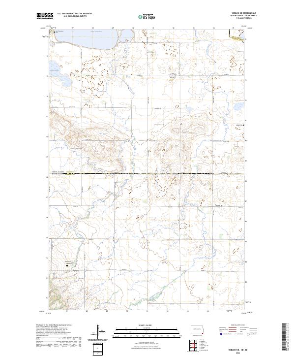
2024 Map of Veblen NE
USGS Topo · Published 2024About this map
Tewaukon National Wildlife Refuge dominates the northern landscape of this prairie terrain, where the waters of Lake Tewaukon and Quaint Slough serve as critical landmarks. This modern survey illustrates the enduring agricultural grid of the Dakota borderlands, bisected by the state line between Sargent County, North Dakota, and Marshall County, South Dakota. The map is particularly valuable for genealogical research, documenting several distinct burial grounds that speak to the area's pioneer settlement history, including the Bergen Cem, Palestine Cem, and the uniquely named Mountainhead - LaBelle Cem. The meandering paths of La Belle Creek and Shortfoot Creek cut across the section lines, revealing the natural drainage patterns that have influenced land use and homestead placement for generations.
Find a feature on this map
29 named features on this map. Tap any name to fly to it.
Don’t see what you’re looking for? This feature index may not catch every label — zoom into the map to look around manually.
Map Details
Editions of this 2024 Veblen NE Map
This is the sole edition of this map. No revisions or reprints were ever made.
Other maps of this area

1907 · Wyndmere
USGS Topo · 1:125,000

1953 · Milbank
USGS Topo · 1:250,000

1953 · Fargo
USGS Topo · 1:250,000

1956 · Fargo
USGS Topo · 1:250,000

1958 · Milbank
USGS Topo · 1:250,000

1958 · Hillhead
USGS Topo · 1:24,000

1958 · Veblen
USGS Topo · 1:24,000

1958 · Marlow
USGS Topo · 1:24,000

1958 · Veblen NE
USGS Topo · 1:24,000

1958 · Geneseo
USGS Topo · 1:24,000