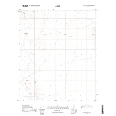
2018 Map of Vekol Mountains NE
USGS Topo · Published 2018About this map
Table Top Mountains dominate the northern landscape of this Pinal County terrain, giving way to the broad expanse of Table Top Valley. This 2018 survey documents a region defined by its ephemeral hydrology and striking geological formations. Water systems like Mesa Wash and Bitter Well Wash underscore the arid character of the Sonoran Desert, where drainage patterns are the primary markers of the landscape's history. To the southwest, the Vekol Mountains rise as a distinct barrier, while the Vaiva Hills mark the eastern reaches of the quadrangle. The map captures the intersection of several townships, including t8s r2e and t9s r3e, providing a clear record of the modern public land survey system in this corner of the Sif Oidak District.
Find a feature on this map
10 named features on this map. Tap any name to fly to it.
Don’t see what you’re looking for? This feature index may not catch every label — zoom into the map to look around manually.
Map Details
Editions of this 2018 Vekol Mountains NE Map
This is the sole edition of this map. No revisions or reprints were ever made.
Other maps of this area

1922 · Casa Grande
USGS Topo · 1:62,500

1924 · Casa Grande
USGS Topo · 1:62,500

1941 · Vekol Mountains
USGS Topo · 1:62,500

1942 · Silver Reef Mountains
USGS Topo · 1:62,500

1942 · Vekol Mountains
USGS Topo · 1:62,500

1946 · Antelope Peak
USGS Topo · 1:62,500

1948 · Antelope Peak
USGS Topo · 1:62,500

1953 · Ajo
USGS Topo · 1:250,000

1956 · Tucson
USGS Topo · 1:250,000

1957 · Ajo
USGS Topo · 1:250,000