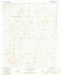
1981 Map of Vekol Mts. NE
USGS Topo · Published 1981About this map
Papago Indian Reservation lands dominate this arid landscape in the early 1980s, characterized by the dramatic rise of the Table Top Mountains in the northwest and the Vaiva Hills to the northeast. The desert floor is defined by drainage patterns like Bitter Well Wash and Mesa Wash, which feed into the broad Santa Rosa Valley. An industrial presence is marked by a prominent Pipeline cutting diagonally across the reservation, alongside a scattered network of 4WD tracks and a single Prospect indicating mineral exploration in the northern hills. The map highlights a subsidence area, suggesting a changing geological profile beneath the surface of these traditional lands.
Find a feature on this map
13 named features on this map. Tap any name to fly to it.
Don’t see what you’re looking for? This feature index may not catch every label — zoom into the map to look around manually.
Map Details
Editions of this 1981 Vekol Mts. NE Map
This is the sole edition of this map. No revisions or reprints were ever made.
Other maps of this area

1922 · Casa Grande
USGS Topo · 1:62,500

1924 · Casa Grande
USGS Topo · 1:62,500

1941 · Vekol Mountains
USGS Topo · 1:62,500

1942 · Silver Reef Mountains
USGS Topo · 1:62,500

1942 · Vekol Mountains
USGS Topo · 1:62,500

1946 · Antelope Peak
USGS Topo · 1:62,500

1948 · Antelope Peak
USGS Topo · 1:62,500

1953 · Ajo
USGS Topo · 1:250,000

1956 · Tucson
USGS Topo · 1:250,000

1957 · Ajo
USGS Topo · 1:250,000