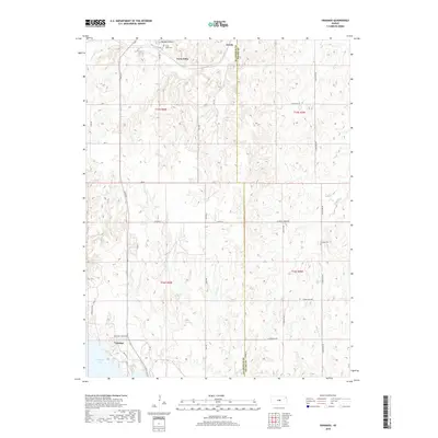
2018 Map of Venango
USGS Topo · Published 2018About this map
Terra Cotta sits at the northern edge of this Kansas landscape where the rolling prairie meets a network of drainage creeks including W Spring Cr and Sand Cr. The settlement pattern here is defined by a rigid grid of rural roads like 28th Rd and Ave K, which cut across the varied topography of Buzzard Roost and the many creek valleys. Near the southern boundary, the terrain descends toward the northern reaches of Kanopolis Lake near the community of Venango. Genealogists and local historians can locate several key landmarks, including the Terra Cotta Cem and Summit Cem, which serve as physical markers of the families who settled this region along the Ellsworth and Saline county line. The map illustrates a typical Central Kansas agricultural landscape, where small hamlets like Arcola are linked by a complex web of named section roads and drainage ways like Wiley Cr and Castle Cr.
Find a feature on this map
37 named features on this map. Tap any name to fly to it.
Don’t see what you’re looking for? This feature index may not catch every label — zoom into the map to look around manually.
Map Details
Editions of this 2018 Venango Map
This is the sole edition of this map. No revisions or reprints were ever made.
Other maps of this area

1892 · Salina
USGS Topo · 1:125,000

1894 · Ellsworth
USGS Topo · 1:125,000

1942 · Salina
USGS Topo · 1:125,000

1955 · Brookville
USGS Topo · 1:24,000

1955 · Falun
USGS Topo · 1:24,000

1955 · Great Bend
USGS Topo · 1:250,000

1955 · Hutchinson
USGS Topo · 1:250,000

1957 · Great Bend
USGS Topo · 1:250,000

1957 · Brookville SW
USGS Topo · 1:24,000

1957 · Westfall SE
USGS Topo · 1:24,000