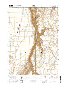
2017 Map of Venator Canyon
USGS Topo · Published 2017About this map
Venator Canyon carves a deep path through the high desert landscape of the Oregon outback, marking a dramatic geological break between the Alkali Valley and the surrounding plateaus. This 2017 survey shows a remote corner of Harney County where water is the primary architect of the terrain, though largely ephemeral as seen in the presence of N Alkali Lake and the smaller Little Mix up Lake. The land is defined by these seasonal catchments and the rugged drainage systems of Rehart Canyon.
Find a feature on this map
19 named features on this map. Tap any name to fly to it.
Don’t see what you’re looking for? This feature index may not catch every label — zoom into the map to look around manually.
Map Details
Editions of this 2017 Venator Canyon Map
This is the sole edition of this map. No revisions or reprints were ever made.
Other maps of this area

1955 · Crescent
USGS Topo · 1:250,000

1955 · Klamath Falls
USGS Topo · 1:250,000

1955 · Burns
USGS Topo · 1:250,000

1955 · Adel
USGS Topo · 1:250,000

1957 · Adel
USGS Topo · 1:250,000

1957 · Crescent
USGS Topo · 1:250,000

1958 · Crescent
USGS Topo · 1:250,000

1958 · Klamath Falls
USGS Topo · 1:250,000

1958 · Burns
USGS Topo · 1:250,000

1958 · Adel
USGS Topo · 1:250,000