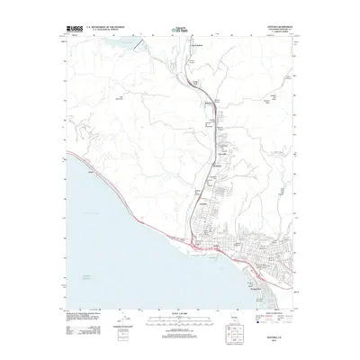
2012 Map of Ventura
USGS Topo · Published 2012About this map
The Ventura River corridor serves as the primary artery of development on this map, connecting the coastal city of Ventura to inland canyon communities. Near the coast, the urban landscape is defined by its relationship with the Pacific Ocean, featuring landmarks such as the Ventura Pier and Ventura City Beach. Historical and cultural sites are prominent, including the Father Serra Cross atop La Loma del and the Memorial Cem.
Find a feature on this map
120 named features on this map. Tap any name to fly to it.
Don’t see what you’re looking for? This feature index may not catch every label — zoom into the map to look around manually.
Map Details
Editions of this 2012 Ventura Map
This is the sole edition of this map. No revisions or reprints were ever made.
Other maps of this area

1903 · Santa Paula
USGS Topo · 1:62,500

1904 · Ventura
USGS Topo · 1:62,500

1904 · Hueneme
USGS Topo · 1:62,500

1941 · Ventura
USGS Topo · 1:62,500

1942 · Santa Paula
USGS Topo · 1:62,500

1942 · Hueneme
USGS Topo · 1:62,500

1943 · Hueneme
USGS Topo · 1:62,500

1947 · Santa Paula
USGS Topo · 1:62,500

1949 · Los Angeles
USGS Topo · 1:250,000

1949 · Oxnard
USGS Topo · 1:24,000