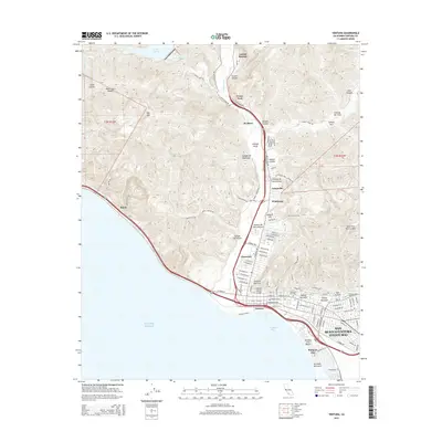
2015 Map of Ventura
USGS Topo · Published 2015About this map
San Buenaventura (Ventura) meets the shore at Pierpont Bay in this 2015 survey, illustrating a landscape where deep coastal canyons intersect with modern urban expansion. The topographic detail follows the Ventura River corridor as it winds south toward the Pacific Ocean, flanked by numerous cañadas such as Cañada Larga and Cañada De San Joaquin. Notable landmarks include the Father Serra Cross overlooking the city and the Memorial Cemetery nearby. This era shows the continued significance of the northern settlements along the river, including Casitas Springs and Foster Park, as the region manages its water resources via Lake Casitas and navigates the steep hillsides of Red Mtn and Gosnell Hill.
Find a feature on this map
95 named features on this map. Tap any name to fly to it.
Don’t see what you’re looking for? This feature index may not catch every label — zoom into the map to look around manually.
Map Details
Editions of this 2015 Ventura Map
This is the sole edition of this map. No revisions or reprints were ever made.
Other maps of this area

1903 · Santa Paula
USGS Topo · 1:62,500

1904 · Ventura
USGS Topo · 1:62,500

1904 · Hueneme
USGS Topo · 1:62,500

1941 · Ventura
USGS Topo · 1:62,500

1942 · Santa Paula
USGS Topo · 1:62,500

1942 · Hueneme
USGS Topo · 1:62,500

1943 · Hueneme
USGS Topo · 1:62,500

1947 · Santa Paula
USGS Topo · 1:62,500

1949 · Los Angeles
USGS Topo · 1:250,000

1949 · Oxnard
USGS Topo · 1:24,000