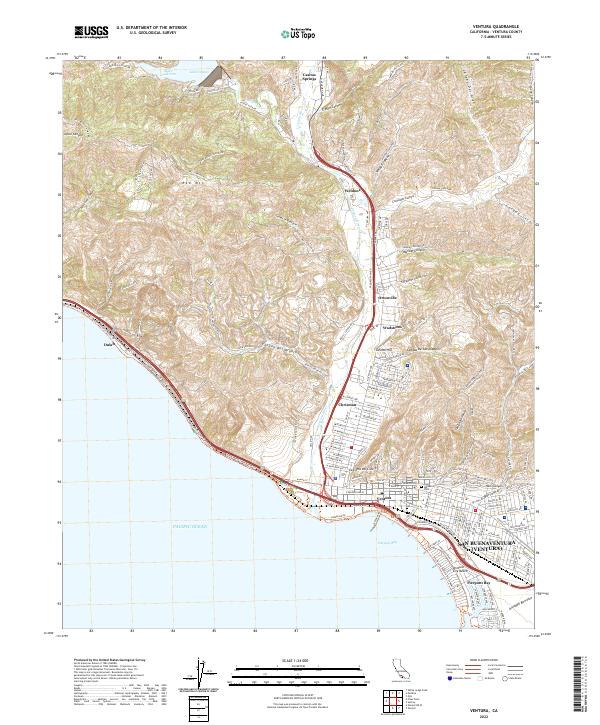
2022 Map of Ventura
USGS Topo · Published 2022About this map
San Buenaventura (Ventura) and its surrounding coastal canyons appear in extensive detail at the start of the 2020s. This survey illustrates the dense urban layout of Ventura proper, contrasting the city's grid with the deep ravines and ridges to the north, including Hall Canyon and Prince Barranca. Along the coastline, the map traces the Pacific Ocean shoreline from Pierpont Bay northwest past the Ventura City Beach toward the smaller settlements of Chrisman and Dulah.
Find a feature on this map
77 named features on this map. Tap any name to fly to it.
Don’t see what you’re looking for? This feature index may not catch every label — zoom into the map to look around manually.
Map Details
Editions of this 2022 Ventura Map
This is the sole edition of this map. No revisions or reprints were ever made.
Other maps of this area

1903 · Santa Paula
USGS Topo · 1:62,500

1904 · Ventura
USGS Topo · 1:62,500

1904 · Hueneme
USGS Topo · 1:62,500

1941 · Ventura
USGS Topo · 1:62,500

1942 · Santa Paula
USGS Topo · 1:62,500

1942 · Hueneme
USGS Topo · 1:62,500

1943 · Hueneme
USGS Topo · 1:62,500

1947 · Santa Paula
USGS Topo · 1:62,500

1949 · Los Angeles
USGS Topo · 1:250,000

1949 · Oxnard
USGS Topo · 1:24,000