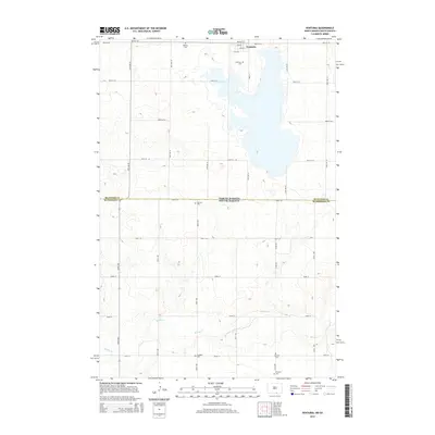
2014 Map of Venturia
USGS Topo · Published 2014About this map
Venturia sits at the northern edge of this high-plains landscape, where the state boundary between North Dakota and South Dakota meets the county line for Mcintosh and Mcpherson. The terrain is defined by a dense concentration of small glacial depressions and basins, a characteristic of the Missouri Coteau region. This 2014 survey reveals a significant genealogical record through its numerous rural burial sites, including the Baptist Cem, Lutheran Cem, and Bertsch Cem scattered across the township sections. The southern half of the map is dominated by the meandering course of Spring Creek, which draws together the drainage from the surrounding prairie. Remote farmsteads are connected by a rigid grid of section-line roads like 330th Ave and 104th St, illustrating the enduring spatial organization of this agricultural borderland.
Find a feature on this map
40 named features on this map. Tap any name to fly to it.
Don’t see what you’re looking for? This feature index may not catch every label — zoom into the map to look around manually.
Map Details
Editions of this 2014 Venturia Map
This is the sole edition of this map. No revisions or reprints were ever made.
Other maps of this area

1953 · Jamestown
USGS Topo · 1:250,000

1954 · Aberdeen
USGS Topo · 1:250,000

1956 · Aberdeen
USGS Topo · 1:250,000

1956 · Jamestown
USGS Topo · 1:250,000

1978 · Wolff Lake
USGS Topo · 1:24,000

1978 · Greenway
USGS Topo · 1:24,000

1978 · Eureka West
USGS Topo · 1:24,000

1978 · Venturia
USGS Topo · 1:24,000

1978 · Eureka East
USGS Topo · 1:24,000

1978 · Schumacher Lake SW
USGS Topo · 1:24,000