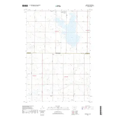
2018 Map of Venturia
USGS Topo · Published 2018About this map
Venturia sits at the northern edge of this prairie landscape, where a grid of rural avenues including 1st Ave and 4th Ave serves the immediate townsite. The surrounding countryside is defined by the high concentration of small, denominational burial grounds that reflect the area's deep-rooted settlement history. These sites, such as the Zion Lutheran Cem, Venturia Baptist Cem, and the family-named Joachim Cem, are scattered across the section lines near the North Dakota-South Dakota border. The hydrology is dominated by a sprawling lake system in the northeast and the meandering course of Spring Cr to the south. This area, spanning the McIntosh and McPherson County line, maintains a traditional agrarian layout with long-established section roads like 100th St SE and Co Hwy 4 providing the primary transit network between scattered homesteads and regional centers.
Find a feature on this map
29 named features on this map. Tap any name to fly to it.
Don’t see what you’re looking for? This feature index may not catch every label — zoom into the map to look around manually.
Map Details
Editions of this 2018 Venturia Map
This is the sole edition of this map. No revisions or reprints were ever made.
Other maps of this area

1953 · Jamestown
USGS Topo · 1:250,000

1954 · Aberdeen
USGS Topo · 1:250,000

1956 · Aberdeen
USGS Topo · 1:250,000

1956 · Jamestown
USGS Topo · 1:250,000

1978 · Wolff Lake
USGS Topo · 1:24,000

1978 · Greenway
USGS Topo · 1:24,000

1978 · Eureka West
USGS Topo · 1:24,000

1978 · Venturia
USGS Topo · 1:24,000

1978 · Eureka East
USGS Topo · 1:24,000

1978 · Schumacher Lake SW
USGS Topo · 1:24,000