
2019 Map of Vera
USGS Topo · Published 2019About this map
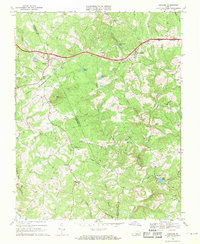
Appomattox Court House National Historical Park anchors the southern portion of this landscape, marking the significant grounds where the American Civil War reached its conclusion. The terrain is defined by the winding course of the Appomattox River and the prominent heights of Bald Mtn and Piney Mtn. The rural character of Appomattox County is evident in the dispersed settlements of Oakville and Vera, connected by a network of roads that hint at former local industries, such as Colemans Mill Rd and Old Grist Mill Rd. Genealogists and local historians will find value in several burial sites preserved across the countryside, including the Patterson-Hix Burial Ground near the park boundary and the Babcock Cem situated north of the river. Small-scale aviation history is represented by Nashs Airport, while the numerous branches and runs like Bent Cr and Rocky Run illustrate the drainage patterns that shaped early land grants and property lines.
Find a feature on this map
65 named features on this map. Tap any name to fly to it.
Don’t see what you’re looking for? This feature index may not catch every label — zoom into the map to look around manually.
Map Details
Editions of this 2019 Vera Map
This is the sole edition of this map. No revisions or reprints were ever made.
Other maps of this area

1892 · Buckingham
USGS Topo · 1:125,000

1892 · Appomattox
USGS Topo · 1:125,000

1947 · Roanoke
USGS Topo · 1:250,000

1958 · Appomattox
USGS Topo · 1:62,500

1958 · Pamplin City
USGS Topo · 1:62,500

1959 · Roanoke
USGS Topo · 1:250,000

1961 · Shipman
USGS Topo · 1:62,500

1961 · Buckingham
USGS Topo · 1:62,500

1963 · Roanoke
USGS Topo · 1:250,000
1968 · Concord
USGS Topo · 1:24,000