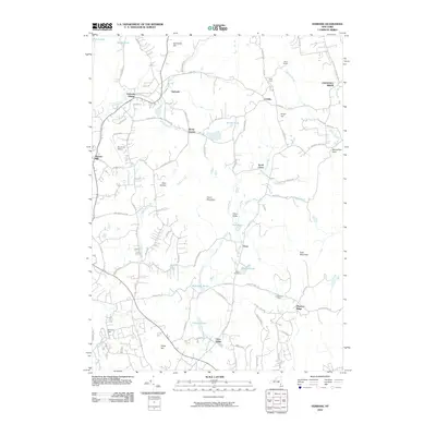
2010 Map of Verbank
USGS Topo · Published 2010About this map
Verbank Village and the surrounding Dutchess County countryside appear here as a landscape of scattered residential clusters and deep-rooted agricultural holdings. The terrain is defined by the prominent Clove Mountain and the high ridge of Chestnut Ridge to the east, which frame the winding paths of Fishkill Creek and Sprout Creek. Historical settlement patterns are visible in localities like Moores Mill and Hoxie Corner, while more recent land uses are represented by Sky Acres Airport and Sherman Field. Local heritage is anchored by the Clove Cemetery and the longstanding community of Clove Valley. The network of local roads, such as Waterbury Hill Rd and Camby Rd, connects various family-named farms and landmarks like CrazyAcres Farm and Hope Farm, reflecting the area's continued identity as a rural New York enclave within the Hudson Valley region.
Find a feature on this map
92 named features on this map. Tap any name to fly to it.
Don’t see what you’re looking for? This feature index may not catch every label — zoom into the map to look around manually.
Map Details
Editions of this 2010 Verbank Map
This is the sole edition of this map. No revisions or reprints were ever made.
Other maps of this area

1893 · Clove
USGS Topo · 1:62,500

1893 · Poughkeepsie
USGS Topo · 1:62,500

1894 · Clove
USGS Topo · 1:62,500

1894 · Poughkeepsie
USGS Topo · 1:62,500

1898 · Clove
USGS Topo · 1:62,500

1898 · Rhinebeck
USGS Topo · 1:62,500

1899 · Millbrook
USGS Topo · 1:62,500

1901 · Clove
USGS Topo · 1:62,500

1902 · Millbrook
USGS Topo · 1:62,500

1903 · Poughkeepsie
USGS Topo · 1:62,500