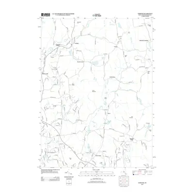
2013 Map of Verbank
USGS Topo · Published 2013About this map
Verbank Village and the historic crossroads at Moores Mill anchor this part of Dutchess County, where the landscape transitions from the residential clusters of the Hudson Valley to the high ridges of the Taconic foothills. The map reveals a valley network defined by Fishkill Cr and Sprout Cr, with numerous small water bodies like Tyrrel Lake and Christie Pond scattered among the hills. Significant land use is dedicated to recreation and aviation, featuring Sky Acres Airport, Sherman Field Airport, and the expansive grounds of The Links at Union Vale. For local historians, the placement of the Clove Cem and the small settlements of Hoxie Corner and North Clove provide clear markers of the area's rural development and longstanding community centers within the Clove Valley.
Find a feature on this map
181 named features on this map. Tap any name to fly to it.
Don’t see what you’re looking for? This feature index may not catch every label — zoom into the map to look around manually.
Map Details
Editions of this 2013 Verbank Map
This is the sole edition of this map. No revisions or reprints were ever made.
Other maps of this area

1893 · Clove
USGS Topo · 1:62,500

1893 · Poughkeepsie
USGS Topo · 1:62,500

1894 · Clove
USGS Topo · 1:62,500

1894 · Poughkeepsie
USGS Topo · 1:62,500

1898 · Clove
USGS Topo · 1:62,500

1898 · Rhinebeck
USGS Topo · 1:62,500

1899 · Millbrook
USGS Topo · 1:62,500

1901 · Clove
USGS Topo · 1:62,500

1902 · Millbrook
USGS Topo · 1:62,500

1903 · Poughkeepsie
USGS Topo · 1:62,500