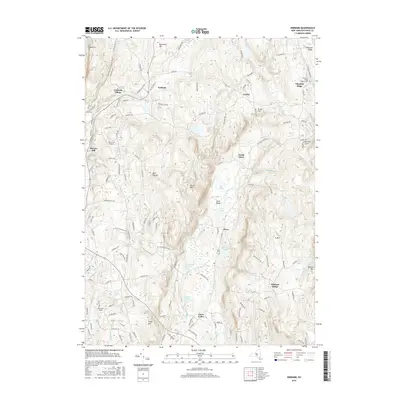
2016 Map of Verbank
USGS Topo · Published 2016About this map
Verbank Village and the surrounding township of Union Vale are defined by a complex drainage network where Sprout Creek and Fishkill Creek cut through the high ridges of Dutchess County. This 2016 survey shows a landscape of long-standing hamlets, including Moores Mill and Clove Valley, connected by a network of historic county roads. The eastern terrain is dominated by Chestnut Ridge and East Mountain, where the Friends Cemetery points to the area's Quaker heritage. Aviation history is represented by Sky Acres Airport, which sits on the elevated plateau west of Dark Hollow. The map provides a detailed look at the rural character of the region, from the wetlands of Pond Gut in the north to the industrial echoes of Furnace Pond in the south, reflecting a transition from early milling and agriculture to modern residential patterns.
Find a feature on this map
141 named features on this map. Tap any name to fly to it.
Don’t see what you’re looking for? This feature index may not catch every label — zoom into the map to look around manually.
Map Details
Editions of this 2016 Verbank Map
This is the sole edition of this map. No revisions or reprints were ever made.
Other maps of this area

1893 · Clove
USGS Topo · 1:62,500

1893 · Poughkeepsie
USGS Topo · 1:62,500

1894 · Clove
USGS Topo · 1:62,500

1894 · Poughkeepsie
USGS Topo · 1:62,500

1898 · Clove
USGS Topo · 1:62,500

1898 · Rhinebeck
USGS Topo · 1:62,500

1899 · Millbrook
USGS Topo · 1:62,500

1901 · Clove
USGS Topo · 1:62,500

1902 · Millbrook
USGS Topo · 1:62,500

1903 · Poughkeepsie
USGS Topo · 1:62,500