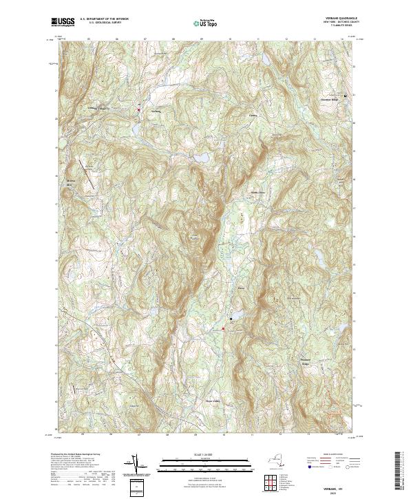
2023 Map of Verbank
USGS Topo · Published 2023About this map
Clove Valley and the surrounding heights of Clove Mountain define the topography of this Dutchess County landscape. The area is marked by a legacy of Quaker settlement, evidenced by the Chestnut Ridge Friends Cem located along the eastern ridge line. Small rural hubs such as Verbank Village, North Clove, and Moores Mill are connected by a network of winding roads like Verbank-Village Rd and Chestnut Ridge Rd. Aviation history is present at Sky Acres Airport and Sherman Field, while the valley floor is characterized by water bodies including Christie Pond, McKinney Pond, and Furnace Pond. The name of the latter suggests a connection to the region's early iron industry, which was historically significant in the Hudson Highlands.
Find a feature on this map
148 named features on this map. Tap any name to fly to it.
Don’t see what you’re looking for? This feature index may not catch every label — zoom into the map to look around manually.
Map Details
Editions of this 2023 Verbank Map
This is the sole edition of this map. No revisions or reprints were ever made.
Other maps of this area

1893 · Clove
USGS Topo · 1:62,500

1893 · Poughkeepsie
USGS Topo · 1:62,500

1894 · Clove
USGS Topo · 1:62,500

1894 · Poughkeepsie
USGS Topo · 1:62,500

1898 · Clove
USGS Topo · 1:62,500

1898 · Rhinebeck
USGS Topo · 1:62,500

1899 · Millbrook
USGS Topo · 1:62,500

1901 · Clove
USGS Topo · 1:62,500

1902 · Millbrook
USGS Topo · 1:62,500

1903 · Poughkeepsie
USGS Topo · 1:62,500