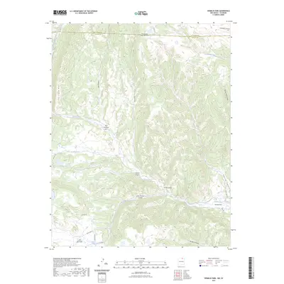
2023 Map of Vermejo Park
USGS Topo · Published 2023About this map
Vermejo Park sits at the heart of this high-elevation landscape in northern Colfax County, where the border between New Mexico and Colorado is defined by the survey line between Las Animas County and Colfax County. The terrain is characterized by a complex network of drainages including the Vermejo River, the North Fork Vermejo River, and the headwaters of the Canadian River. Named topographical features such as The Little Wall and San Francisco Pass suggest the traditional routes and natural barriers that have shaped movement through these canyons for generations. The map reveals a remote backcountry crossed by primitive roads like Bear Camp Rd and Bartlett Rd, leading to secluded spots such as Merrick Lake and Castle Rock Park. Notable landmarks like Crazy Woman Canyon and Bubbling Springs reflect the local nomenclature of this ranching and wilderness area.
Find a feature on this map
28 named features on this map. Tap any name to fly to it.
Don’t see what you’re looking for? This feature index may not catch every label — zoom into the map to look around manually.
Map Details
Editions of this 2023 Vermejo Park Map
This is the sole edition of this map. No revisions or reprints were ever made.
Other maps of this area

1891 · Spanish Peaks
USGS Topo · 1:125,000

1893 · Spanish Peaks
USGS Topo · 1:125,000

1895 · Spanish Peaks
USGS Topo · 1:125,000

1897 · Spanish Peaks
USGS Topo · 1:125,000

1900 · Spanish Peaks
USGS Topo · 1:125,000

1954 · Raton
USGS Topo · 1:250,000

1954 · Trinidad
USGS Topo · 1:250,000

1955 · Trinidad
USGS Topo · 1:250,000

1958 · Raton
USGS Topo · 1:250,000

1958 · Trinidad
USGS Topo · 1:250,000