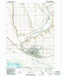
1994 Map of Vermillion
USGS Topo · Published 1995About this map
University of South Dakota dominates the cultural landscape of this college town during the mid-1990s, featuring landmarks like the Dakotadome and the W H Over Museum. The Missouri River and Vermillion River define the southern and western borders of the settlement, shaping the local geography near the Nebraska border. To the north, the elevation rises toward Spirit Mound, a prominent landmark within the Prairie Center area. This survey documents the expansion of Vermillion through its residential streets and parks, including Prentis Park and Sertoma Park, while capturing the rural character of the surrounding Clay County farmland. Notable genealogical sites include Bluff View Cemetery and the more remote Clay Creek Cem, providing a record of local family history alongside rural institutions like St Agnes Ch and Alliance Ch.
Find a feature on this map
49 named features on this map. Tap any name to fly to it.
Don’t see what you’re looking for? This feature index may not catch every label — zoom into the map to look around manually.
Map Details
Editions of this 1994 Vermillion Map
This is the sole edition of this map. No revisions or reprints were ever made.
Other maps of this area

1898 · Elk Point
USGS Topo · 1:125,000

1901 · Elk Point
USGS Topo · 1:125,000

1907 · Elk Point
USGS Topo · 1:125,000

1955 · Sioux City
USGS Topo · 1:250,000

1958 · Sioux City
USGS Topo · 1:250,000

1959 · Sioux City
USGS Topo · 1:250,000

1964 · Burbank
USGS Topo · 1:24,000

1964 · Maskell
USGS Topo · 1:24,000

1968 · Obert
USGS Topo · 1:24,000
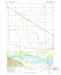
1968 · Meckling
USGS Topo · 1:24,000
Featured Places
- Vermillion, SD
- Vermillion Township, SD
- Spirit Mound Township, SD
- Fairview Township, SD
- Hooker Township, NE