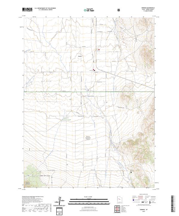
2023 Map of Vernon
USGS Topo · Published 2023About this map
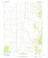
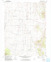
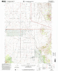
Vernon serves as the central hub of this high-desert basin, situated within the broad expanse of Rush Valley. The landscape is defined by its transition from the valley floor to the prominent Vernon Hills in the northeast and the rising Sheeprock Mountains to the southwest. This area is heavily influenced by large-scale land management, featuring the Wasatch National Forest and the Benmore Experimental Pastures, which illustrate the region's agricultural and research heritage. A complex network of watercourses, including Vernon Creek, Dutch Creek, and Bennion Creek, drains the surrounding highlands toward the valley. Local historical sites such as the Vernon Cem and the Chief Green Jacket Grave provide specific points of interest for genealogists and local historians, anchoring the map's geographical data with tangible markers of the area's human history.
Find a feature on this map
47 named features on this map. Tap any name to fly to it.
Don’t see what you’re looking for? This feature index may not catch every label — zoom into the map to look around manually.
Map Details
Editions of this 2023 Vernon Map
This is the sole edition of this map. No revisions or reprints were ever made.
Historical Maps of Vernon Through Time
4 maps found