1971 Map of Vernon
USGS Topo · Published 1974About this map
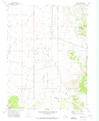
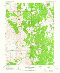
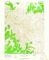
The settlement of Vernon sits at the northern edge of Rush Valley, serving as a central point in a landscape defined by high-altitude ranching and forest management in the early 1970s. The map highlights the transition from the valley floor to the Vernon Hills and the slopes of the Onaqui Mountains. A notable point of historical interest is the Chief Green Jacket Grave located near Bennion Creek in the southeastern portion of the quadrangle. Extensive land use patterns are evident through the Benmore Experimental Pastures and the Benmore (Site), suggesting a shift from former habitations to agricultural research and livestock management within the Wasatch National Forest. Water sources like Vernon Creek and Dutch Creek are critical features in this arid environment, alongside the Vernon Airstrip and Vernon Cem.
Find a feature on this map
29 named features on this map. Tap any name to fly to it.
Don’t see what you’re looking for? This feature index may not catch every label — zoom into the map to look around manually.
Map Details
Editions of this 1971 Vernon Map
This is the sole edition of this map. No revisions or reprints were ever made.
Other maps of this area

1885 · Sevier Desert
USGS Topo · 1:250,000

1885 · Tooele Valley
USGS Topo · 1:250,000

1953 · Tooele
USGS Topo · 1:250,000

1953 · Delta
USGS Topo · 1:250,000

1955 · Tooele
USGS Topo · 1:250,000

1958 · Delta
USGS Topo · 1:250,000

1962 · Delta
USGS Topo · 1:250,000
1963 · Sabie Mountain
USGS Topo · 1:24,000
1963 · Dutch Peak
USGS Topo · 1:24,000

1971 · Vernon NE
USGS Topo · 1:24,000