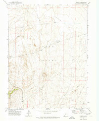
1971 Map of Vernon NE
USGS Topo · Published 1974About this map
The Site of Rush Valley Pony Express Station anchors this high-desert landscape in Tooele County, marking a historic transit corridor through the Rush Valley. This 1971 survey illustrates the spatial relationship between old pioneer trails and mid-century industrial infrastructure, notably the Union Pacific rail line cutting through the southwestern corner near the Vernon Hills. The map captures an arid environment defined by seasonal water sources like Sabie Creek and Boulter Creek, alongside land-use indicators such as Corrals, a Borrow Pit, and an isolated Prospect. A notable northern Depression and several wells suggest the ongoing challenges of water management in this interior basin during the early 1970s.
Find a feature on this map
15 named features on this map. Tap any name to fly to it.
Don’t see what you’re looking for? This feature index may not catch every label — zoom into the map to look around manually.
Map Details
Editions of this 1971 Vernon NE Map
This is the sole edition of this map. No revisions or reprints were ever made.
Other maps of this area

1885 · Tooele Valley
USGS Topo · 1:250,000

1915 · Fairfield
USGS Topo · 1:62,500

1917 · Fairfield
USGS Topo · 1:62,500

1918 · Stockton
USGS Topo · 1:62,500

1947 · Fivemile Pass
USGS Topo · 1:62,500

1947 · Boulter Peak
USGS Topo · 1:24,000

1949 · Fivemile Pass
USGS Topo · 1:24,000

1953 · Tooele
USGS Topo · 1:250,000

1955 · Stockton
USGS Topo · 1:62,500

1955 · Tooele
USGS Topo · 1:250,000