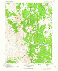
1963 Map of Sabie Mountain
USGS Topo · Published 1964About this map
Tintic Mountains and the Sheeprock Mountains dominate this 1960s study of the high-desert border between Tooele and Juab counties. The landscape is defined by its water sources and livestock infrastructure, featuring remote seasonal outposts like Summer Ranch and Dry Farm. A complex network of springs, including Powell Spring, Sabie Spring, and Keg Spring, supported the early ranching and transit through this territory. Infrastructure of the mid-century is evident along the eastern edge, where the Union Pacific railroad and a significant Aqueduct run parallel through the valley. Resource extraction is also visible near the northern boundary, marked by Gravel Pits and a Quarry situated near Boulter Creek. The map provides a detailed view of the Wasatch National Forest boundary and the historic Sabie Trail as they climb toward Sabie Mtn, offering a clear picture of the region's topography before modern development.
Find a feature on this map
32 named features on this map. Tap any name to fly to it.
Don’t see what you’re looking for? This feature index may not catch every label — zoom into the map to look around manually.
Map Details
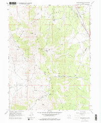
Editions of this 1963 Sabie Mountain Map
2 editions found
Other maps of this area

1885 · Sevier Desert
USGS Topo · 1:250,000

1885 · Tooele Valley
USGS Topo · 1:250,000

1947 · Fivemile Pass
USGS Topo · 1:62,500

1947 · Boulter Peak
USGS Topo · 1:24,000

1953 · Tooele
USGS Topo · 1:250,000

1953 · Delta
USGS Topo · 1:250,000

1954 · Mc Intyre
USGS Topo · 1:24,000

1954 · Tintic Junction
USGS Topo · 1:24,000

1955 · Tooele
USGS Topo · 1:250,000

1958 · Delta
USGS Topo · 1:250,000