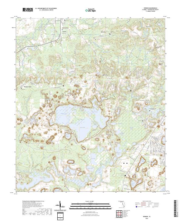
2024 Map of Vernon
USGS Topo · Published 2024About this map
Vernon serves as a focal point in this portion of the Florida Panhandle, situated where Holmes Creek winds through the landscape. The area is defined by a high density of rural burial sites and places of worship, including the Vernon-Evangelistic Center Church Cem and Moss Hill Church Cem, reflecting the deep-rooted family genealogies of Washington County. To the south, the terrain transitions into a complex system of wetlands and small water bodies such as Boggy Lake and Sweetwater Lake. The map reveals a settlement pattern of small communities like Sylvania and Holmes Valley, connected by local routes like McFatter Ave and Ebenezer Rd. These corridors link family-named landmarks like Weaver Hill and Hudson Hill with the many small ponds that characterize this lake-heavy region.
Find a feature on this map
184 named features on this map. Tap any name to fly to it.
Don’t see what you’re looking for? This feature index may not catch every label — zoom into the map to look around manually.
Map Details
Editions of this 2024 Vernon Map
This is the sole edition of this map. No revisions or reprints were ever made.
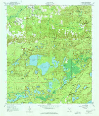
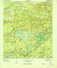
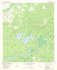
Historical Maps of Macom Through Time
4 maps found