1951 Map of Vernon
USGS Topo · Published 1951About this map
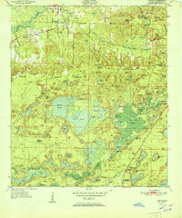
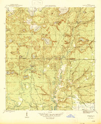
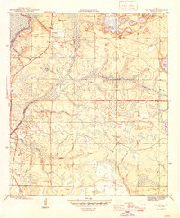
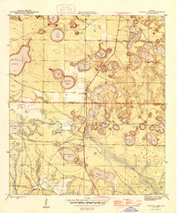
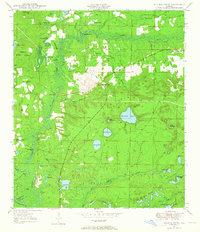
Vernon serves as the focal point of this Northwest Florida landscape, situated where Holmes Creek winds through the northern portion of the quadrangle. The surrounding terrain is defined by a intricate system of wetlands and isolated water bodies, including the expansive Hicks Pond and Lucas Pond near the center of the sheet. This mid-century survey reveals a rural society structured around local community centers, with several country churches and schools scattered across the pine-heavy lowlands. Features such as Moss Hill Ch, Abigail Ch, and the Massalene Sch indicate established neighborhood nodes during the early 1950s. To the south, the settlement at Panama Heights and the Greenhead Crystal Lake PO mark the southern reaches of the county, while the eastern edge is dominated by the dense Pine Log Swamp and Holmes Valley Swamp, illustrating the natural drainage patterns that shaped local development.
Find a feature on this map
85 named features on this map. Tap any name to fly to it.
Don’t see what you’re looking for? This feature index may not catch every label — zoom into the map to look around manually.
Map Details
Editions of this 1951 Vernon Map
This is the sole edition of this map. No revisions or reprints were ever made.
Other maps of this area

1944 · Crystal Lake
USGS Topo · 1:24,000

1944 · Bennett
USGS Topo · 1:24,000
1945 · Bennett
USGS Topo · 1:31,680
1945 · Red Head
USGS Topo · 1:31,680
1945 · Crystal Lake
USGS Topo · 1:31,680
1949 · Millers Ferry
USGS Topo · 1:24,000

1949 · Hinsons Cross Roads
USGS Topo · 1:24,000
1950 · Millers Ferry
USGS Topo · 1:24,000
1950 · Hinsons Cross Roads
USGS Topo · 1:24,000
1950 · Vernon
USGS Topo · 1:24,000