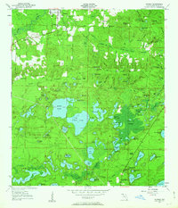
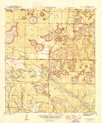
1950 Map of Vernon
USGS Topo · Published 1963About this map
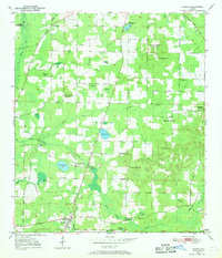
Holmes Creek and Pippin Mill Creek wind through the wetlands of Washington County, defining a landscape dominated by dozens of named bays, ponds, and slues. In the early 1950s, the area around Vernon remained a patchwork of rural gathering places, evidenced by the high density of country churches and schools. Local community life was anchored at sites like Moss Hill Ch, Abigail Ch, and Sylvania Ch, while education was distributed across rural campuses including Vernon Sch, Greenhead Sch, and Massalene Sch. To the south, the settlement of Greenhead is marked by the Greenhead Post Office near Panama Heights. The mapping captures a specific water-rich geography where family and community landmarks like Tiller Cem and Potter Cem sit on higher ground above the Holmes Valley Swamp and the numerous small basins such as Baptizing Pond and Hoys Maltby Bay.
Find a feature on this map
107 named features on this map. Tap any name to fly to it.
Don’t see what you’re looking for? This feature index may not catch every label — zoom into the map to look around manually.
Map Details
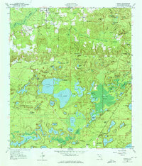
Editions of this 1950 Vernon Map
2 editions found
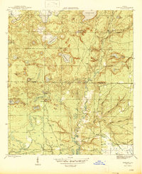
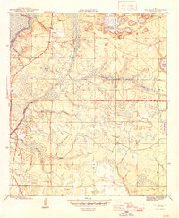
Other maps of this area

1944 · Crystal Lake
USGS Topo · 1:24,000

1944 · Bennett
USGS Topo · 1:24,000
1945 · Bennett
USGS Topo · 1:31,680
1945 · Red Head
USGS Topo · 1:31,680
1945 · Crystal Lake
USGS Topo · 1:31,680
1949 · Millers Ferry
USGS Topo · 1:24,000

1949 · Hinsons Cross Roads
USGS Topo · 1:24,000
1950 · Millers Ferry
USGS Topo · 1:24,000
1950 · Hinsons Cross Roads
USGS Topo · 1:24,000
1950 · Wausau
USGS Topo · 1:24,000