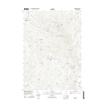
2015 Map of Vershire
USGS Topo · Published 2015About this map
Vershire and its surrounding hamlets occupy a landscape of high ridges and narrow valleys defined by the winding course of the Ompompanoosuc River. The network of small settlements, including Vershire Heights, Vershire Center, and South Vershire, reflects a history of decentralized community centers typical of upland Vermont. Significant local landmarks such as Goodhue Ledge and Eagle Ledge dominate the central topography, while the eastern edge follows the river valley through Brimstone Corner and West Fairlee. Genealogists will find a high density of family and community burial grounds, from the Spear-Norris Cem in the northwest to the Cook-Huse-Fulton Cem further south. The presence of the Post Mills Airport Private near the southern boundary at Post Mills highlights the modernization of transport in this otherwise rural interior, even as names like Old City and Mill Village hint at earlier industrial and settlement nodes along the tributary waters of Old City Brook.
Find a feature on this map
81 named features on this map. Tap any name to fly to it.
Don’t see what you’re looking for? This feature index may not catch every label — zoom into the map to look around manually.
Map Details
Editions of this 2015 Vershire Map
This is the sole edition of this map. No revisions or reprints were ever made.
Other maps of this area

1896 · Strafford
USGS Topo · 1:62,500

1931 · Mt. Cube
USGS Topo · 1:62,500

1931 · Woodsville
USGS Topo · 1:48,000

1933 · Mt. Cube
USGS Topo · 1:62,500

1935 · Woodsville
USGS Topo · 1:62,500

1941 · Woodsville
USGS Topo · 1:62,500

1944 · Strafford
USGS Topo · 1:62,500

1947 · Corinth
USGS Topo · 1:62,500

1948 · East Barre
USGS Topo · 1:62,500

1950 · Glens Falls
USGS Topo · 1:250,000