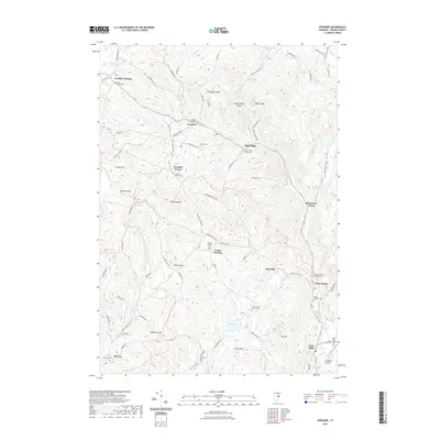
2021 Map of Vershire
USGS Topo · Published 2021About this map
The Ompompanoosuc River winds through this Orange County landscape, carving a path through the steep terrain of the Upper Valley region. The 2021 topography reflects a classic Vermont pattern of small, dispersed hamlets such as Vershire, Mill Village, and South Vershire, each connected by a network of winding roads like Eagle Hollow Rd and Vershire Center Rd. Local history is preserved in numerous family and community burial grounds, including the Spear - Norris Cem and the Cook - Huse - Fulton Cem. While much of the area is defined by peaks like Patterson Mtn and Hawkins Mtn, the valley floors support vital infrastructure like the Post Mills Airport. The concentration of settlements and named hills like Colton Hill and Gilman Hill illustrates how the upland geography has dictated residential growth and land use in this part of Vermont.
Find a feature on this map
89 named features on this map. Tap any name to fly to it.
Don’t see what you’re looking for? This feature index may not catch every label — zoom into the map to look around manually.
Map Details
Editions of this 2021 Vershire Map
This is the sole edition of this map. No revisions or reprints were ever made.
Other maps of this area

1896 · Strafford
USGS Topo · 1:62,500

1931 · Mt. Cube
USGS Topo · 1:62,500

1931 · Woodsville
USGS Topo · 1:48,000

1933 · Mt. Cube
USGS Topo · 1:62,500

1935 · Woodsville
USGS Topo · 1:62,500

1941 · Woodsville
USGS Topo · 1:62,500

1944 · Strafford
USGS Topo · 1:62,500

1947 · Corinth
USGS Topo · 1:62,500

1948 · East Barre
USGS Topo · 1:62,500

1950 · Glens Falls
USGS Topo · 1:250,000