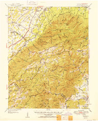
1951 Map of Vesuvius
USGS Topo · Published 1951About this map
The Blue Ridge landscape during the early 1950s is defined by a distinct mix of industrial infrastructure and isolated mountain life. The Norfolk and Western railway corridor serves as a spine for western settlements like Lofton, Vesuvius, and Steeles Tavern, while an Aerial Tramway and Pipeline reflect mid-century utility expansion across the ridges. Higher elevations are characterized by the Big Levels Game Refuge and peaks like The Priest and The Cardinal.
Find a feature on this map
156 named features on this map. Tap any name to fly to it.
Don’t see what you’re looking for? This feature index may not catch every label — zoom into the map to look around manually.
Map Details
Editions of this 1951 Vesuvius Map
2 editions found
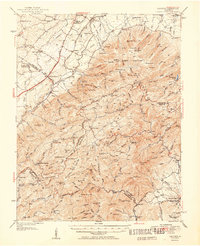
Other maps of this area

1892 · Buckingham
USGS Topo · 1:125,000

1892 · Harrisonburg
USGS Topo · 1:125,000

1894 · Staunton
USGS Topo · 1:125,000

1894 · Lexington
USGS Topo · 1:125,000

1932 · Lexington
USGS Topo · 1:48,000

1934 · Waynesboro
USGS Topo · 1:48,000

1935 · Buena Vista
USGS Topo · 1:48,000

1935 · Amherst
USGS Topo · 1:48,000

1936 · Vesuvius
USGS Topo · 1:48,000

1937 · Lexington
USGS Topo · 1:62,500