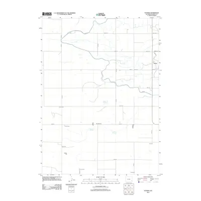
2012 Map of Veteran
USGS Topo · Published 2012About this map
The small unincorporated community of Veteran serves as a focal point in this portion of Goshen County, where the high plains landscape is defined by extensive ranching operations and water management. Named family holdings like the E G House Ranch, K Yorges Ranch, and Carlson Ranch are connected by a geometric grid of county roads, illustrating the legacy of the Homestead Act and the structured land division of the West. Significant water resources including Eaton Reservoir, Yorges Reservoir, and Likins Reservoir suggest the critical importance of irrigation and livestock watering in this arid environment. Natural landmarks such as Red Bill Hill, Little Red Bill Hill, and Millies Hill rise above the surrounding terrain, providing orientation across the vast open country.
Find a feature on this map
38 named features on this map. Tap any name to fly to it.
Don’t see what you’re looking for? This feature index may not catch every label — zoom into the map to look around manually.
Map Details
Editions of this 2012 Veteran Map
This is the sole edition of this map. No revisions or reprints were ever made.
Other maps of this area

1896 · Patrick
USGS Topo · 1:125,000

1896 · Hartville
USGS Topo · 1:125,000

1899 · Goshen Hole
USGS Topo · 1:125,000

1901 · Hartville
USGS Topo · 1:125,000

1950 · Rockeagle
USGS Topo · 1:24,000

1954 · Torrington
USGS Topo · 1:250,000

1954 · Cheyenne
USGS Topo · 1:250,000

1958 · Cheyenne
USGS Topo · 1:250,000

1958 · Torrington
USGS Topo · 1:250,000

1960 · Habig Spring
USGS Topo · 1:24,000