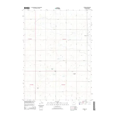
2015 Map of Veteran
USGS Topo · Published 2015About this map
Veteran serves as the primary settlement within this Goshen County landscape, situated near the western edge of a region defined by agricultural infrastructure and distinct high points. The terrain is marked by a series of family-named landmarks including Red Bill Hill, Little Red Bill Hill, and Millies Hill, suggesting the long-standing influence of local ranching or homesteading families. Water management is central to the area's layout, as evidenced by a network of basins such as Eaton Reservoir, Yorges Reservoir, and Likins Reservoir. A strictly organized grid of rural corridors, including Red Bill Rd and Canal Rd, provides access across the townships of t23n r63w and t22n r64w, reflecting the systematic Bureau of Land Management surveying that has guided the development of this eastern Wyoming high plains territory.
Find a feature on this map
26 named features on this map. Tap any name to fly to it.
Don’t see what you’re looking for? This feature index may not catch every label — zoom into the map to look around manually.
Map Details
Editions of this 2015 Veteran Map
This is the sole edition of this map. No revisions or reprints were ever made.
Other maps of this area

1896 · Patrick
USGS Topo · 1:125,000

1896 · Hartville
USGS Topo · 1:125,000

1899 · Goshen Hole
USGS Topo · 1:125,000

1901 · Hartville
USGS Topo · 1:125,000

1950 · Rockeagle
USGS Topo · 1:24,000

1954 · Torrington
USGS Topo · 1:250,000

1954 · Cheyenne
USGS Topo · 1:250,000

1958 · Cheyenne
USGS Topo · 1:250,000

1958 · Torrington
USGS Topo · 1:250,000

1960 · Habig Spring
USGS Topo · 1:24,000