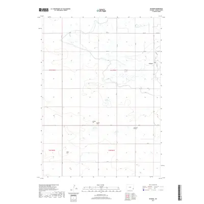
2017 Map of Veteran
USGS Topo · Published 2017About this map
Veteran serves as the primary settlement in this corner of Goshen County, situated in a landscape characterized by its agricultural water management. The topography is defined by significant high points including Red Bill Hill, Little Red Bill Hill, and Millies Hill, which overlook a series of vital water catchments. These include Eaton Reservoir, Yorges Reservoir, and Likins Reservoir, reflecting the essential nature of irrigation and livestock watering in this prairie environment. The area is gridded by a network of rural roads such as Co RD 108 and RD 50, facilitating movement between the isolated ranching properties and the town center at Veteran. This survey offers a clear view of the modern rural infrastructure and the geographic relationship between these named hills and the essential water resources that sustain the high plains community.
Find a feature on this map
32 named features on this map. Tap any name to fly to it.
Don’t see what you’re looking for? This feature index may not catch every label — zoom into the map to look around manually.
Map Details
Editions of this 2017 Veteran Map
This is the sole edition of this map. No revisions or reprints were ever made.
Other maps of this area

1896 · Patrick
USGS Topo · 1:125,000

1896 · Hartville
USGS Topo · 1:125,000

1899 · Goshen Hole
USGS Topo · 1:125,000

1901 · Hartville
USGS Topo · 1:125,000

1950 · Rockeagle
USGS Topo · 1:24,000

1954 · Torrington
USGS Topo · 1:250,000

1954 · Cheyenne
USGS Topo · 1:250,000

1958 · Cheyenne
USGS Topo · 1:250,000

1958 · Torrington
USGS Topo · 1:250,000

1960 · Habig Spring
USGS Topo · 1:24,000