2021 Map of Veteran
USGS Topo · Published 2021About this map
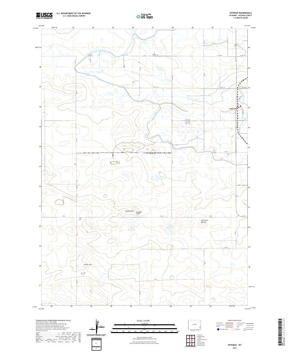
Veteran anchors this high plains landscape, situated near the intersection of several irrigation systems that transformed the local economy. The intricate path of the Fort Laramie Canal winds through the northern sections, supplemented by the Cherry Cr Drain and Cherry Cr Lateral, reflecting a highly engineered water management network designed for Goshen County agriculture. This 2021 survey highlights the reliance on man-made water storage, including Eaton Reservoir, Yorges Reservoir, and Likins Reservoir. Prominent topographical markers such as Red Bill Hill, Red Bill Point, and Little Red Bill Hill provide relief in the terrain, while family-named features like Millies Hill offer a point of interest for local genealogists. The map also delineates the precise township and range boundaries for T23N and T22N, essential for tracing land ownership records in this rural Wyoming corridor.
Find a feature on this map
33 named features on this map. Tap any name to fly to it.
Don’t see what you’re looking for? This feature index may not catch every label — zoom into the map to look around manually.
Map Details
Editions of this 2021 Veteran Map
This is the sole edition of this map. No revisions or reprints were ever made.