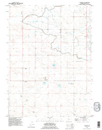
1990 Map of Veteran
USGS Topo · Published 1995About this map
Agricultural development and water management define this portion of Goshen County, centered on the settlement of Veteran. The landscape is dominated by the sophisticated irrigation network that supports the region's ranching operations, including the Fort Laramie Canal, an Aqueduct, and various drainage systems like the Box Elder Drain. These waterworks feed several significant catchments, notably Eaton Reservoir and Likins Reservoir, which are vital for sustaining the high-plains agriculture visible here.
Find a feature on this map
25 named features on this map. Tap any name to fly to it.
Don’t see what you’re looking for? This feature index may not catch every label — zoom into the map to look around manually.
Map Details
Editions of this 1990 Veteran Map
This is the sole edition of this map. No revisions or reprints were ever made.
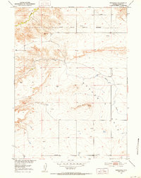
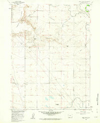
Other maps of this area

1896 · Patrick
USGS Topo · 1:125,000

1896 · Hartville
USGS Topo · 1:125,000

1899 · Goshen Hole
USGS Topo · 1:125,000

1901 · Hartville
USGS Topo · 1:125,000
1950 · Rockeagle
USGS Topo · 1:24,000

1954 · Torrington
USGS Topo · 1:250,000

1954 · Cheyenne
USGS Topo · 1:250,000

1958 · Cheyenne
USGS Topo · 1:250,000

1958 · Torrington
USGS Topo · 1:250,000
1960 · Habig Spring
USGS Topo · 1:24,000