Loading...
Loading map...2022 Map of Vicco
USGS Topo · Published 2022About this map
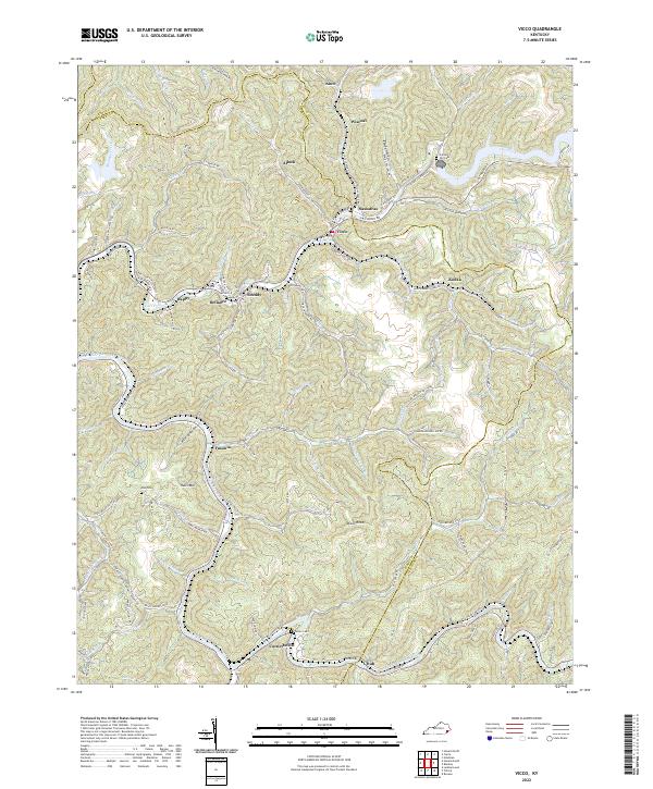
The North Fork Kentucky River snakes through the southern reaches of this Appalachian landscape, where steep hollows and ridges define the settlement patterns of Perry, Knott, and Letcher counties. In the heart of the coalfields, towns like Vicco and Sassafras occupy the narrow valley floors along Carr Fork, while smaller settlements such as Defiance, Happy, and Scuddy are tucked into the drainages of Scuddy Br and Hurricane Br.
Find a feature on this map
86 named features on this map. Tap any name to fly to it.
Don’t see what you’re looking for? This feature index may not catch every label — zoom into the map to look around manually.
Map Details
Date Portrayed2022
Date Published2022
PublisherU.S. Geological Survey
Map TypeTopographic
Scale1:24000
Physical Dimensions24 x 29 inches
Editions of this 2022 Vicco Map
This is the sole edition of this map. No revisions or reprints were ever made.
Historical Maps of Kodak Through Time
Featured Locations
Source Details
SourceU.S. Geological Survey
CopyrightPublic Domain