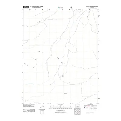
2011 Map of Vicente Canyon
USGS Topo · Published 2011About this map
Vicente Canyon and the surrounding high-desert landscape of Conejos County are defined by a complex network of drainage systems and rugged landforms. The water management of the region is anchored by the Horned Owl Retention Dam, while the natural hydrography is dominated by the winding course of La Jara Creek and the La Jara Arroyo. These waterways have carved deep impressions into the earth, resulting in numerous named topographical features such as Garambuyo Gulch and the prominent Flat Top.
Find a feature on this map
14 named features on this map. Tap any name to fly to it.
Don’t see what you’re looking for? This feature index may not catch every label — zoom into the map to look around manually.
Map Details
Editions of this 2011 Vicente Canyon Map
This is the sole edition of this map. No revisions or reprints were ever made.
Other maps of this area

1922 · Conejos
USGS Topo · 1:125,000

1945 · Durango
USGS Topo · 1:250,000

1953 · Durango
USGS Topo · 1:250,000

1954 · Durango
USGS Topo · 1:250,000

1961 · Durango
USGS Topo · 1:250,000

1963 · Durango
USGS Topo · 1:250,000

1966 · Durango
USGS Topo · 1:250,000
1967 · Osier
USGS Topo · 1:24,000
1967 · La Jara Canyon
USGS Topo · 1:24,000
1967 · Centro
USGS Topo · 1:24,000