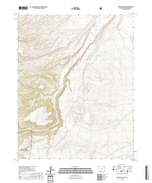
2022 Map of Vicente Canyon
USGS Topo · Published 2022About this map
The Rio Grande National Forest dominates the southwestern portion of this 2022 survey, where the high-altitude landscape is defined by a series of dramatic canyon systems. Named drainages like Vicente Canyon, Leandro Canyon, and Canyon del Rancho converge as they descend toward the La Jara Canyon floor. These topographical features suggest a complex hydrological network that has shaped the land use and access patterns in this part of Conejos County.
Find a feature on this map
21 named features on this map. Tap any name to fly to it.
Don’t see what you’re looking for? This feature index may not catch every label — zoom into the map to look around manually.
Map Details
Editions of this 2022 Vicente Canyon Map
This is the sole edition of this map. No revisions or reprints were ever made.
Other maps of this area

1922 · Conejos
USGS Topo · 1:125,000

1945 · Durango
USGS Topo · 1:250,000

1953 · Durango
USGS Topo · 1:250,000

1954 · Durango
USGS Topo · 1:250,000

1961 · Durango
USGS Topo · 1:250,000

1963 · Durango
USGS Topo · 1:250,000

1966 · Durango
USGS Topo · 1:250,000
1967 · Osier
USGS Topo · 1:24,000
1967 · La Jara Canyon
USGS Topo · 1:24,000
1967 · Centro
USGS Topo · 1:24,000