
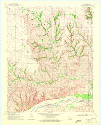
1969 Map of Vici
USGS Topo · Published 1972About this map
Vici serves as the primary hub in this West Oklahoma landscape, situated at the intersection of the Missouri Kansas Texas railroad and the local highway network. The terrain is defined by the Old Indian Treaty Boundary that cuts east-west across the map, separating Woodward Co and Dewey Co. This historic line underscores the region's transition from indigenous lands to organized ranching and agricultural townships like Detroit and Johnson.
Find a feature on this map
22 named features on this map. Tap any name to fly to it.
Don’t see what you’re looking for? This feature index may not catch every label — zoom into the map to look around manually.
Map Details
Editions of this 1969 Vici Map
This is the sole edition of this map. No revisions or reprints were ever made.
Other maps of this area

1955 · Woodward
USGS Topo · 1:250,000

1958 · Woodward
USGS Topo · 1:250,000

1969 · Vici NW
USGS Topo · 1:24,000

1969 · Woodward SW
USGS Topo · 1:24,000

1969 · Sharon
USGS Topo · 1:24,000

1969 · Mooreland SW
USGS Topo · 1:24,000

1969 · Mutual SW
USGS Topo · 1:24,000

1969 · Mutual
USGS Topo · 1:24,000

1969 · Camargo
USGS Topo · 1:24,000
1970 · Vici SW
USGS Topo · 1:24,000