1970 Map of Vicksboro
USGS Topo · Published 1973About this map
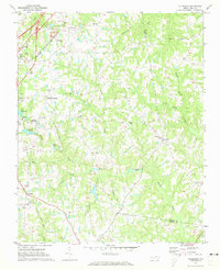
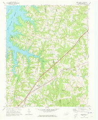
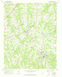
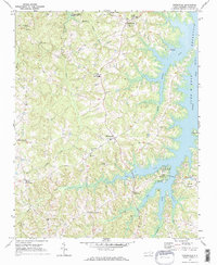
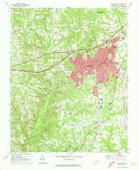
Vicksboro and the surrounding Vance County landscape in 1970 reveal a rural district defined by the Seaboard Coast Line railroad and numerous small agricultural crossroads. The presence of Weldons Mill on Dickies Creek suggests a legacy of local milling, while the network of community spaces like Phipps Chapel, New Sandy Creek Ch, and Carver Sch highlights the social centers for regional families. Industrial and institutional footprints are visible at the Quarry near Greystone and the County Correction Unit in the southern portion of the quadrangle. For those interested in mid-century cultural artifacts, the map even records the location of a Drive-in Theater near Brookston. The terrain is etched with numerous named waterways, including Sandy Creek and Shocco Creek, which flow through a topography of small family ponds and wooded branches.
Find a feature on this map
56 named features on this map. Tap any name to fly to it.
Don’t see what you’re looking for? This feature index may not catch every label — zoom into the map to look around manually.
Map Details
Editions of this 1970 Vicksboro Map
This is the sole edition of this map. No revisions or reprints were ever made.
Other maps of this area

1953 · Greensboro
USGS Topo · 1:250,000

1954 · Greensboro
USGS Topo · 1:250,000

1962 · Greensboro
USGS Topo · 1:250,000

1966 · Greensboro
USGS Topo · 1:250,000
1970 · Middleburg
USGS Topo · 1:24,000
1970 · Warrenton
USGS Topo · 1:24,000
1970 · Townsville
USGS Topo · 1:24,000
1970 · Henderson
USGS Topo · 1:24,000
1971 · Afton
USGS Topo · 1:24,000
1977 · Middleburg
USGS Topo · 1:24,000