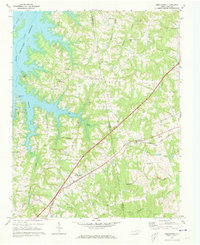
1970 Map of Middleburg
USGS Topo · Published 1973About this map
The Seaboard Coast Line railroad cuts a sharp diagonal through this landscape, anchoring the rural communities of Middleburg and Manson during a period of transition in Vance and Warren counties. To the west, the expansive John H Kerr Reservoir has reshaped the terrain, creating numerous inlets along Anderson Creek and Mill Creek. This 1970 snapshot records the early development of Soul City, a planned community founded with the aim of providing economic opportunities for Black families in the rural South.
Find a feature on this map
37 named features on this map. Tap any name to fly to it.
Don’t see what you’re looking for? This feature index may not catch every label — zoom into the map to look around manually.
Map Details
Editions of this 1970 Middleburg Map
2 editions found
Other maps of this area

1953 · Greensboro
USGS Topo · 1:250,000

1954 · Greensboro
USGS Topo · 1:250,000

1955 · Boydton
USGS Topo · 1:62,500

1962 · Greensboro
USGS Topo · 1:250,000

1966 · Greensboro
USGS Topo · 1:250,000

1968 · Bracey
USGS Topo · 1:24,000
1968 · Tungsten
USGS Topo · 1:24,000

1968 · John H Kerr Dam
USGS Topo · 1:24,000

1970 · Vicksboro
USGS Topo · 1:24,000
1970 · Warrenton
USGS Topo · 1:24,000