
1955 Map of Boydton
USGS Topo · Published 1957About this map
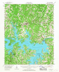
Boydton serves as the hub of this Mecklenburg County landscape during the mid-1950s, a period defined by the massive presence of the Kerr Reservoir. The map illustrates the dramatic transformation of the Roanoke River valley following the completion of the Kerr Dam, which inundated traditional terrain and created complex shorelines around former high ground like Island Hill. Beyond the water's edge, the map documents a transition in transportation and industry, featuring the Jefferson Davis Highway alongside the Atlantic and Danville Railway and the Southern Ry. Local institutions are well-represented, including the Bluestone High School and several rural centers such as Baskerville and Finchley. Evidence of the region's industrial and social character appears in labels for Tungsten, Case Quarry, and even the State Prison Camp No 4, providing a detailed look at the infrastructure of south-central Virginia.
Find a feature on this map
115 named features on this map. Tap any name to fly to it.
Don’t see what you’re looking for? This feature index may not catch every label — zoom into the map to look around manually.
Map Details
Editions of this 1955 Boydton Map
2 editions found
Other maps of this area

1941 · Clarksville
USGS Topo · 1:48,000

1943 · Clarksville
USGS Topo · 1:62,500

1953 · Oxford
USGS Topo · 1:62,500

1953 · Greensboro
USGS Topo · 1:250,000

1954 · Greensboro
USGS Topo · 1:250,000

1954 · Clover
USGS Topo · 1:62,500

1955 · Chase City
USGS Topo · 1:62,500

1955 · Kenbridge
USGS Topo · 1:62,500

1957 · Clarksville
USGS Topo · 1:62,500

1962 · Greensboro
USGS Topo · 1:250,000