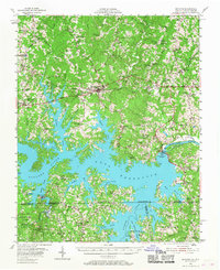
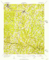
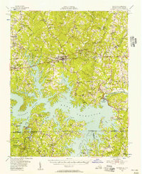
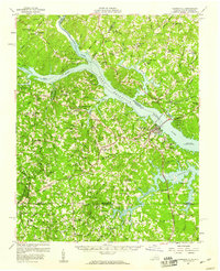
1955 Map of Boydton
USGS Topo · Published 1968About this map
Boydton serves as a central hub in Southside Virginia, where the Atlantic and Danville Highway intersects with the Jefferson Davis Highway during the mid-1950s. The landscape is defined by the massive John H. Kerr Reservoir, created by the Kerr Dam, which altered the course of the Roanoke River and submerged land near Buggs Island. This era of transformation is captured as the rising waters shaped new shorelines around Whits Point and Panhandle Creek.
Find a feature on this map
105 named features on this map. Tap any name to fly to it.
Don’t see what you’re looking for? This feature index may not catch every label — zoom into the map to look around manually.
Map Details
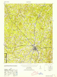
Editions of this 1955 Boydton Map
2 editions found
Other maps of this area

1941 · Clarksville
USGS Topo · 1:48,000

1943 · Clarksville
USGS Topo · 1:62,500
1953 · Oxford
USGS Topo · 1:62,500

1953 · Greensboro
USGS Topo · 1:250,000

1954 · Greensboro
USGS Topo · 1:250,000
1954 · Clover
USGS Topo · 1:62,500
1955 · Chase City
USGS Topo · 1:62,500
1955 · Kenbridge
USGS Topo · 1:62,500
1955 · Boydton
USGS Topo · 1:62,500
1957 · Clarksville
USGS Topo · 1:62,500