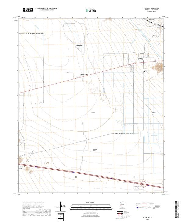
2021 Map of Vicksburg
USGS Topo · Published 2021About this map
Vicksburg sits at the northern edge of the Ranegras Plain, where local roads like McVay Rd and Vicksburg Rd intersect the desert landscape of La Paz County. This 2021 survey documents a contemporary view of the region, defined by its massive water infrastructure and remote desert settlements. The Central Arizona Project Aqueduct cuts a prominent path across the northeast, a critical lifeline through an arid environment shaped by several seasonal drainages, including Bouse Wash, Calcite Wash, and Granite Wash.
Find a feature on this map
30 named features on this map. Tap any name to fly to it.
Don’t see what you’re looking for? This feature index may not catch every label — zoom into the map to look around manually.
Map Details
Editions of this 2021 Vicksburg Map
This is the sole edition of this map. No revisions or reprints were ever made.
Historical Maps of Vicksburg Through Time
4 maps found