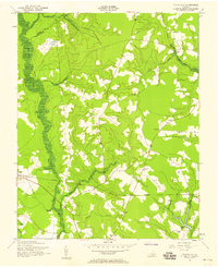
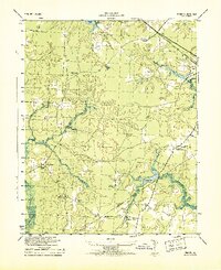
1957 Map of Vicksville
USGS Topo · Published 1958About this map
The Virginian railroad cuts a straight path through the heart of this coastal plain landscape, connecting the rural communities of Sebrell and Vicksville. This mid-century survey by the Army Map Service and USGS illustrates a social geography defined by local landmarks, including the Southampton Lookout Tower and a network of schools such as Brown Doyle Sch and Ricks Sch. The terrain is characterized by the expansive Assamoosick Swamp and numerous branches like Indigo Branch and Coscorie Branch, which dictate the placement of roads and homesteads. Local commerce and congregational life center around points like Thornton Store and St Lukes Ch. At the southern edge, the Nottoway River and Darden Millpond anchor the map, with the Darden Scout Reservation occupying the nearby woodlands, reflecting the area's transition toward recreational land use alongside traditional timber and agricultural patterns.
Find a feature on this map
28 named features on this map. Tap any name to fly to it.
Don’t see what you’re looking for? This feature index may not catch every label — zoom into the map to look around manually.
Map Details
Editions of this 1957 Vicksville Map
This is the sole edition of this map. No revisions or reprints were ever made.
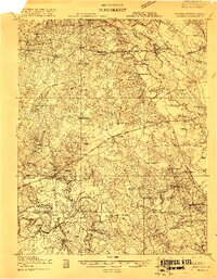
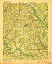
Other maps of this area

1919 · Homeville
USGS Topo · 1:48,000
1919 · Boykins
USGS Topo · 1:48,000

1920 · Holland
USGS Topo · 1:62,500

1920 · Ivor
USGS Topo · 1:62,500

1920 · Homeville
USGS Topo · 1:62,500
1920 · Boykins
USGS Topo · 1:62,500

1943 · Holland
USGS Topo · 1:62,500
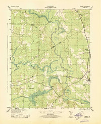
1943 · Sebrell
USGS Topo · 1:31,680
1943 · Manry
USGS Topo · 1:31,680
1943 · Littleton
USGS Topo · 1:31,680