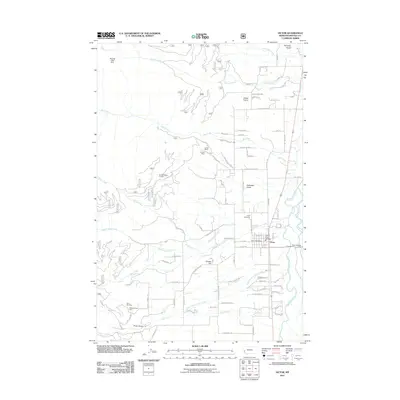
2011 Map of Victor
USGS Topo · Published 2011About this map
The Victor community serves as the primary hub of this Bitterroot Valley landscape, situated along the Bitterroot River and its western tributaries. Local infrastructure is well-defined by landmarks like the Victor Post Office, the Victor Rural Fire Dept, and the Victor Cemetery. This 2011 survey reveals an area where residential development and agricultural plots meet the rising terrain of the Bitterroot Range to the west.
Find a feature on this map
76 named features on this map. Tap any name to fly to it.
Don’t see what you’re looking for? This feature index may not catch every label — zoom into the map to look around manually.
Map Details
Editions of this 2011 Victor Map
This is the sole edition of this map. No revisions or reprints were ever made.
Other maps of this area

1901 · Hamilton
USGS Topo · 1:125,000

1912 · Missoula
USGS Topo · 1:125,000

1956 · Hamilton
USGS Topo · 1:250,000

1959 · Hamilton
USGS Topo · 1:250,000

1960 · Hamilton
USGS Topo · 1:250,000

1964 · Hamilton
USGS Topo · 1:250,000

1964 · St. Joseph Peak
USGS Topo · 1:24,000
1966 · Printz Ridge
USGS Topo · 1:24,000
1966 · Gash Point
USGS Topo · 1:24,000
1967 · Saint Mary Peak
USGS Topo · 1:24,000