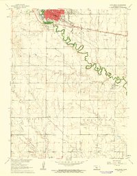
1961 Map of Victoria
USGS Topo · Published 1962About this map
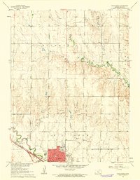
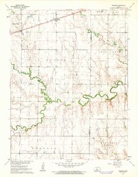
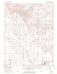
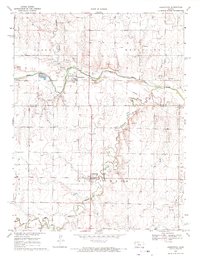
Victoria serves as the primary hub on this central Kansas landscape, situated where the Union Pacific railroad and U.S. Route 40 parallel the meandering course of Big Creek. The map documents a significant intersection of heritage and industry, notably featuring the St Fidelis Cem and St George Cem, which reflect the area's deep-rooted community ties. Beyond the town limits, the terrain is marked by numerous Oil Wells and a Sandpit, illustrating the post-war extraction economy that shaped Ellis County during this era.
Find a feature on this map
29 named features on this map. Tap any name to fly to it.
Don’t see what you’re looking for? This feature index may not catch every label — zoom into the map to look around manually.
Map Details
Editions of this 1961 Victoria Map
This is the sole edition of this map. No revisions or reprints were ever made.
Other maps of this area
1896 · Hays
USGS Topo · 1:125,000

1955 · Great Bend
USGS Topo · 1:250,000

1957 · Great Bend
USGS Topo · 1:250,000

1958 · Great Bend
USGS Topo · 1:250,000
1961 · Hays South
USGS Topo · 1:24,000
1961 · Catharine
USGS Topo · 1:24,000
1961 · Hays North
USGS Topo · 1:24,000
1961 · Walker
USGS Topo · 1:24,000
1967 · Gorham
USGS Topo · 1:24,000
1968 · Liebenthal
USGS Topo · 1:24,000