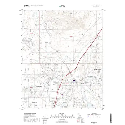
2018 Map of Victorville
USGS Topo · Published 2018About this map
The Mojave River valley serves as the central corridor for this detailed study of the High Desert during its 21st-century expansion. The map documents the extensive urban footprints of Victorville, Adelanto, and Apple Valley, where suburban street grids meet the stark topography of the Mojave Desert. Notable for aviation researchers, the Southern California Logistics Airport dominates the northwest, showing a complex of runways and hangers including Aviation Dr and Airport Flightline Blvd. In the north, the settlement of Oro Grande sits near the Rodigues Cem and the National Trails Hwy, the legendary Route 66. This survey captures the topographical constraints of the river's path, from the Upper Narrows near Victor Valley Memorial Park to the Lower Narrows, where the desert terrain rises into features like Quartzite Mtn and Sugarloaf.
Find a feature on this map
281 named features on this map. Tap any name to fly to it.
Don’t see what you’re looking for? This feature index may not catch every label — zoom into the map to look around manually.
Map Details
Editions of this 2018 Victorville Map
This is the sole edition of this map. No revisions or reprints were ever made.
Other maps of this area

1901 · Southern California Sheet No. 1
USGS Topo · 1:250,000

1902 · Deep Creek
USGS Topo · 1:62,500

1902 · Hesperia
USGS Topo · 1:62,500

1904 · Southern California Sheet No. 1
USGS Topo · 1:250,000

1932 · Barstow
USGS Topo · 1:125,000

1934 · Barstow
USGS Topo · 1:125,000

1942 · Hesperia
USGS Topo · 1:62,500

1953 · San Bernardino
USGS Topo · 1:250,000

1956 · San Bernardino
USGS Topo · 1:250,000
1956 · Baldy Mesa
USGS Topo · 1:24,000