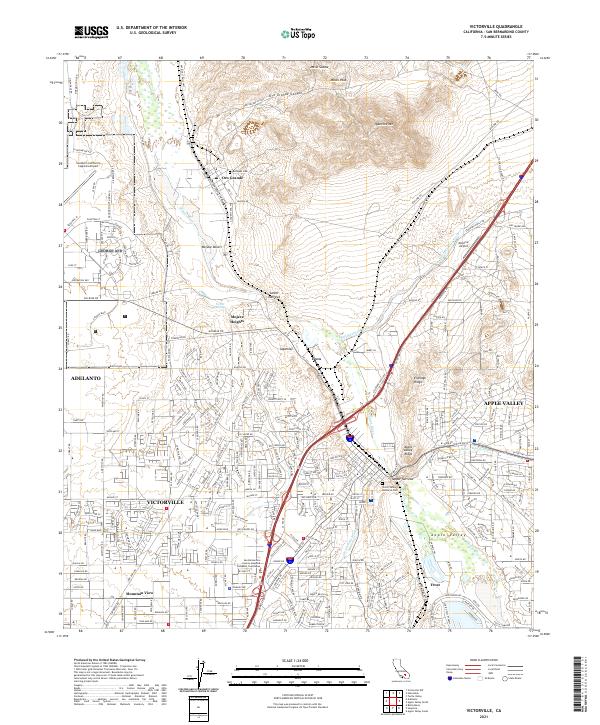
2021 Map of Victorville
USGS Topo · Published 2021About this map
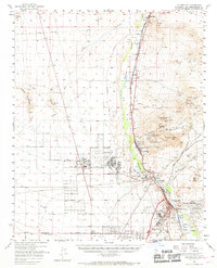
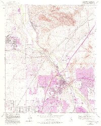
The Mojave River carves through this high desert corridor, defining the path for the BNSF Railway and the historic National Trails Hwy. To the north, the terrain is dominated by the industrial character of Oro Grande and the topographic elevations of Quartzite Mtn and Macks Peak. This 2021 survey illustrates the massive footprint of the Southern California Logistics Airport on the former George Air Force Base site, surrounded by the growing residential and civic hubs of Adelanto and Victorville. Local history is anchored by sites like the Rodigues Cem and the San Bernardino County-Joseph B Campbell Courthouse. The map highlights the area's transition from desert wilderness to a major logistics and residential center, with neighborhood labels like Mountain View and Mojave Heights filling in the gaps between the rugged Eldridge Ridge and the Mojave Desert floor.
Find a feature on this map
315 named features on this map. Tap any name to fly to it.
Don’t see what you’re looking for? This feature index may not catch every label — zoom into the map to look around manually.
Map Details
Editions of this 2021 Victorville Map
This is the sole edition of this map. No revisions or reprints were ever made.
Historical Maps of Golden Mesa Through Time
4 maps found